HNV farmland likelihood in Ireland

Using 5 variables available at a national scale a map of HNV farmland likelihood was created at an Electoral Division scale. These were Corine landcover data split into three classes; farmed semi-natural land, semi-natural land and non-semi-natural land;  average stocking density; hedgerow density;  river and stream density and soils diversity. Variables 1 and 2 were given a greater weighting as they are more influential for HNV farming systems than the remaining variables.

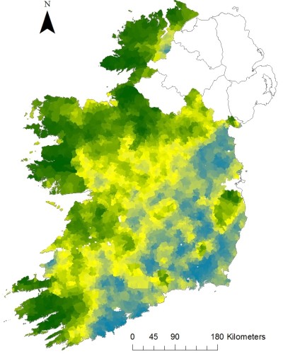
Online_ED_HNV_map

Green colours indicate high likelihood of having HNV farmland, yellow indicates intermediate likelihood of having HNV farmland and blue colours indicate low likelihood of having HNV farmland

*Note: This map is a potential map and must be interpreted within the limitations of the data used to produce the map. The colour assigned to the grid indicates the likelihood of finding HNV farms in this area. Regardless of the colour assigned to the grid there may be a range of farms from intensively to extensively managed.